

The company has a variety of topographic equipment, most of it being new – 3 GNSS equipment, 2 total stations, 1 optical level, 5 laptops, A0 color plotter, multifunctional A3-A4, 2 vehicles four-wheel drive etc. – and specialized software (ex. CAD, surveying data processing application, customized applications etc.), which allow the automation of a large part of processing the raw surveying data collected on site.
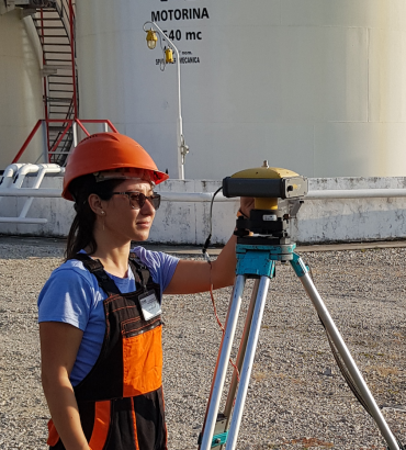
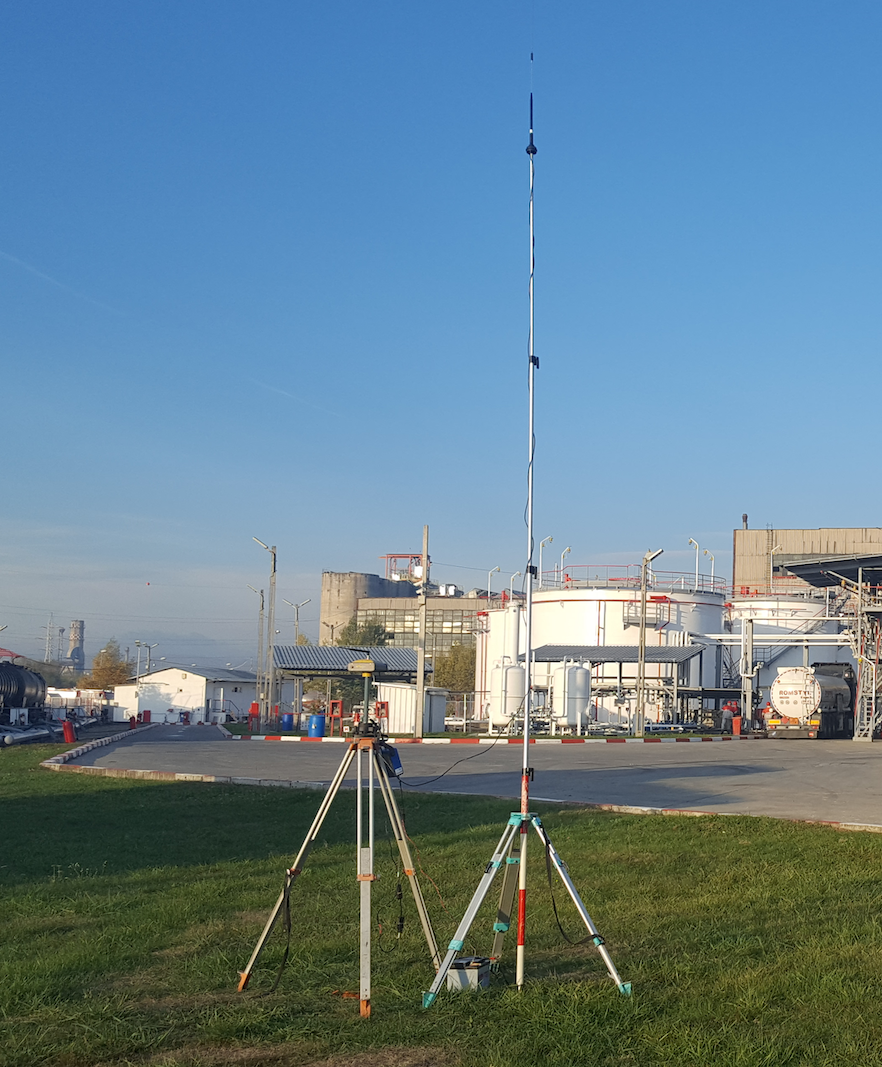
Please see below a short presentation of the topograhic equipment used for the on-site works.
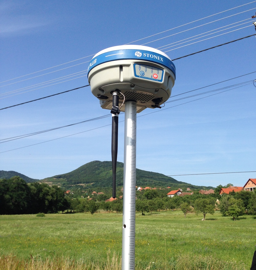
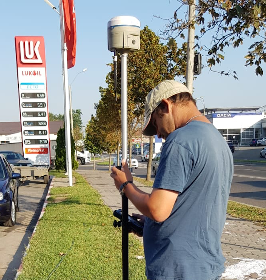
GNSS Stonex S9III UHF PLUS is the result of the continuous evolution of the integrated GNSS STONEX receivers. The integrated radio modem, which sends and receives ultra high frequencies, with a transmission power up to 2W, makes possible the use of this equipment as powerful GPS corrections source on the construction sites, topographic surveys for cadastre purposes etc.
General features:
- Channels: 220;
- RTK signal initialization < 10 sec;
- Signal reacquisition <1 sec;
- Internal memory: 256 Mb (over 15 days of raw static data storage with recording sample every 15 seconds);
- Bluetooth 2,4 GHz class II, maximum range is 50 m
Satellite tracked:
- GPS: simultaneous L1 C/A, L2E, L2C, L5
- GLONASS: simultaneous L1 C/A, L1 P, L2 C/A (only GLONASS M), L2 P
- SBAS: simultaneous L1 C/A, L5
- GIOVE-A: simultaneous L1 BOC, E5A, E5B, E5AltBOC1.
- GIOVE-B: simultaneous L1 CBOC, E5A, E5B, E5AltBOC1.
- COMPASS: (reserved): B1 (QPSK), B1-MBOC (6, 1, 1/11), B1-2 (QPSK), B2 (QPSK), B2-BOC (10, 5), B3 (QPSK), B3BOC (15, 2.5), L5 (QPSK).
Receiver precision:
- Horizontal static: ±2,5 mm + 1 ppm (RMS)
- Vertical static: ±5 mm + 1 ppm (RMS)
- Horizontal RTK: ±0,8 cm + 1 ppm (RMS)
- Vertical RTK: ±2 cm + 1 ppm (RMS)
- SBAS positioning:
- vertical < 5 m (3D RMS);
- horizontal <1m (3D RMS)
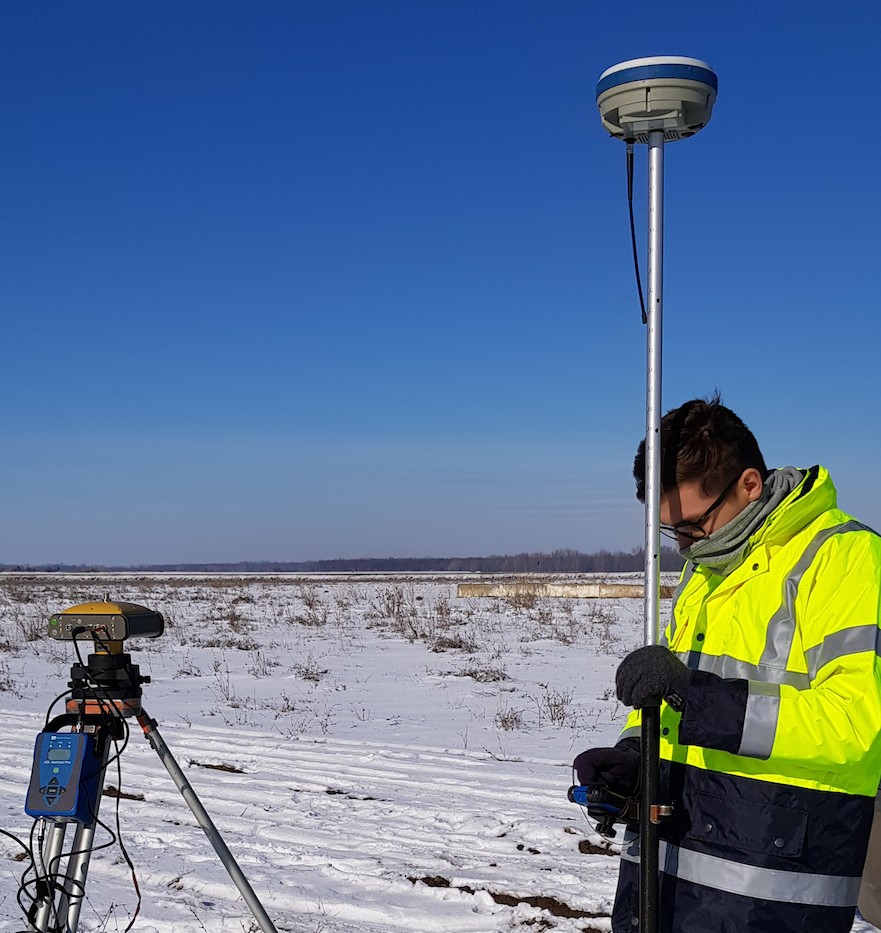
GNSS Stonex S10
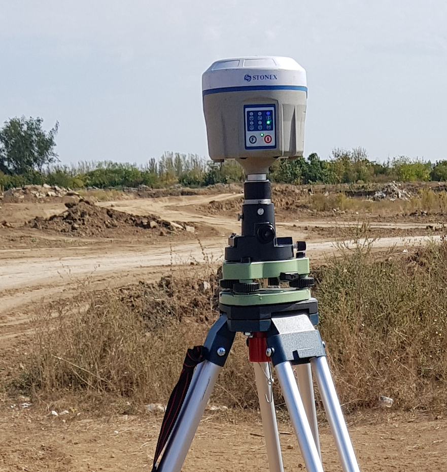
GNSS Stonex S10 is one of the most advanced integrated GNSS receivers and it’s part of a new generation of intelligent GNNS equipment on which you can install customized applications directly in the receiver. The advanced features of Stonex S10, as the automated adjustment of the height with the electronic bubble, make it possible for faster collecting the surveying data and with a higher precision.
General features:
- Channels: 220;
- RTK signal initialization < 10 sec;
- Signal reacquisition <1 sec;
- Internal memory: 4 GB (over 60 days of raw static data storage with recording sample every second);
- Bluetooth 2,4 GHz class II, maximum range is 50 m;
- Auxiliary Inertial System – facilitates the positioning in some special sites, such as corners, pipelines, edges of walls,
- Tilt centering – corrects the coordinates of the collected points depending on the tilt angle and direction. Thus, there is no longer need to precisely center the equipment for collecting correct surveying data.
Satellite tracked:
- GPS: simultaneous L1 C/A, L2E, L2C, L5
- GLONASS: simultaneous L1 C/A, L1 P, L2 C/A, L2 P, L3
- SBAS: simultaneous L1 C/A, L5
- GALILEO: E1, E5A, E5B
- COMPASS: B1, B2
Receiver precision:
- Horizontal static: ±2,5 mm + 1 ppm (RMS)
- Vertical static: ±5 mm + 1 ppm (RMS)
- Horizontal RTK: ±1 cm + 1 ppm (RMS)
- Vertical RTK: ±1,5 cm + 1 ppm (RMS)
- Acuratete tipică de poziţionare SBAS:
- vertical < 5 m (3D RMS),
- orizontal <1m (3D RMS)
GNSS Topcon Hyper Pro
GNSS Topcon Hyper Pro with double frequency L1 & L2 is meant and built to give a high precision and safety of the surveyed points’ position, even during very difficult on-site conditions.
- Channels: 40 canale
- Satellite tracked: L1/L2 C/A; P Code & Carrier; GLONASS
- RTK signal initialization < 10 sec;
- Signal reacquisition < 1 sec;
Precision of the receiver:
- Orizontal static: 3mm+ 0.5ppm
- Vertical static: 5mm+ 0.5ppm
- Orizontal RTK: 10mm+ 1.0ppm
- Vertical RTK: 15mm+ 1.0ppmHorizontal static: 3mm+ 0.5ppm
- Vertical static: 5mm+ 0.5ppm
- Horizontal RTK: 10mm+ 1.0ppm
- Vertical RTK: 15mm+ 1.0ppm
- Antenna: Integrated
- Radio: Intern, send/ receive ultra high frequencies, transmission power 0,25 – 1 W
- Bluetooth Vers. 1.1
Radio extern ADL Vantage Pro

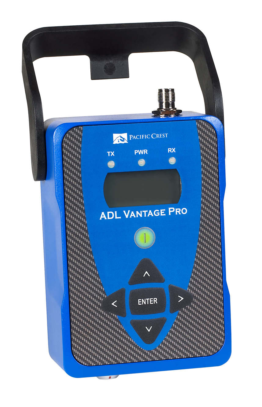
Radio extern ADL Vantage Pro (made by Pacific Crest) & Repeater SETTOP. The technical features of this external radio makes the use of it in a network with GNSS equipment to provide greater accuracy and speed in performing topographic measurements, data transmission rate radio frequency being very high (19,200 bits / second).
Normally, in order to perform topographic measurements, the GNSS equipment should continuously receive the signals of the closest permanent GNSS station from the ROMPOS system. When the closest permanent GNSS station from the ROMPOS system is still far away or it does not function, the measurements are difficult or impossible to achieve.
Therefore, for a better accuracy and speed in making topographic surveys with GNSS equipment, we use the ADL Vantage Pro external radio and the SETTOP repeater which make the on-site works independent from the national system of permanent GNSS stations – ROMPOS (Romanian Positioning System) so that the topographic surveys can be done without depending on the functionality or the proximity of these permanent GNSS.
The radio has a transmission power up to 35W, which can cover an area of approximately 40 km and the number of the GNSS equipment that can be connected with it is unlimited. Thus, the speed of topographic surveys depends only on the number of operators and available GNSS equipment.
The radio conforms to the safety requirements provided by the European Council Directive 1999/5/EC.
Our company is licensed by the National Authority for Management and Regulation in Communications in Romania – http://www.ancom.org.ro – for the use of the assigned radio frequencies throughout the counties we execute topographic surveys with the aid of this external radio.
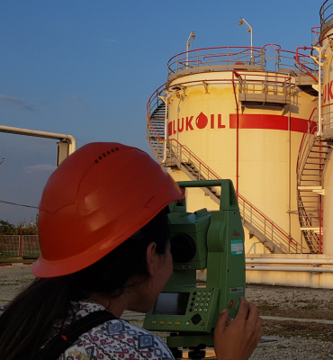
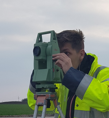
Leica TCR 805 total station
Summary general features:
| Telescope: | Magnification – 30x Image – vertical; Free objective aperture – 40 mm; Focusing – 1.7m; Field of view – 1°30’ Field of view at 100m: 2.6m |
| Angle measurement: | Absolute, continuous; Updates each 0.3 seconds Accuracy standard deviation – 5”(mgon) |
| Automatic corrections: | Vertical index error, Earth curvature, refraction, tilt |
| Recording: | Interfata RS232; Memorie interna – 576 KB (10000 blocuri de date sau 16000 puncte fixe); |
Leica TCRA 1101 total station
- Automatic Target Recognition – ATR/LOCK
- Rapid search of the target with PowerSearch
Summary general features:
| Telescope: | Magnification – 30x Image – vertical; Free objective aperture – 40 mm; Focusing – 1.7m; Field of view – 1°30’ Field of view at 100m: 2.7m Transit: fully |
| Angle measurement: | Setting accuracy – 0,5”(0,2 mgon) |
| Corectii automate pentru: | Focusing line error, vertical index error, tilting axes error, main axes error, Earth curvature, refraction, circle eccentricity. |
| Recording: | RS232 interface; Internal memory – 5 MB (36000 – 90000 data blocks); |


